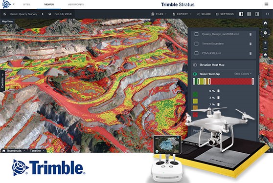
Data-Driven Decisions with Trimble Stratus Drone Processing SolutionsQuarry surveying using aerial drones is becoming common across Canada. Drones slash surveying times from months to days, with accurate measurements of stockpiles, haul roads and more. |
|||

|
|||

|
Trimble Inc. 10368 Westmoor Dr, Westminster, CO 80021, United States +1-800-361-1249 • aggregates@trimble.com CASL | Privacy | Accessibility |Unsubscribe If you visit any links we will provide your subscription contact info (not your email) to the advertiser or sponsor. Copyright ©yyyy Annex Business Media P.O. Box 530, 105 Donly Drive S, Simcoe, ON, CANADA N3Y 4N5 customercare@annexbusinessmedia.com Customer Service: Tel 1-800-668-2374 |